Jackson considering contract for landslide mapping
 Four years after a state landslide mapping project for Jackson County was axed midstream, the commissioners are moving toward a vote to fund the work out of county coffers.
“I’ve been supportive of that (landslide mapping) for quite some time,” said Commissioner Brian McMahan, who included the need for such mapping in his election platform last year. “I just think it’s a tool that we need here in the county available for residents to use and have better protection.”
Jennifer Bauer of Appalachian Landslide Consultants, who had been working on the mapping back when it was a state-funded project, gave commissioners an overview last week of what the work would entail, how it could help homeowners and what the final price tag would likely be — $143,000 for a year of inventory and six months of map creation and community education.
That’s down a bit from ALC’s proposal last year to do the work for $158,000 — a difference, Bauer said, that’s due to changes in the modeling process.
Still, it’s a hefty price tag. But McMahan believes it will prove worthwhile.
“If we are able to save one house from being destroyed because of a potential slide, then it pays for itself,” McMahan said, echoing a point Bauer made during her presentation. The average home value in Western North Carolina is $165,000, Bauer said, which is more than the cost of the mapping.
Related Items

Drought arrives in the mountains

WNC courts receive much-needed help

Jackson tables FRL governance change

What would a library be without ‘outside influences’?
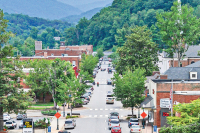
The western counties form a region of steep topography and heavy rainfall, the makings of a landslide-prone area. Landslides can happen when the top of a slope becomes oversaturated with water, causing the soil to flow downhill. Landslides can also happen when intact chunks of earth detach and move down. And while they can happen on undeveloped property, development substantially increases the risk. Of the 202 landslides that have been inventoried in Jackson County, 70 percent happened on modified slopes, with the remaining 30 percent happening on natural slopes.
The state had formed a landslide mapping team to quantify the hazard in the mountain counties, starting work in 2005. But in 2011, the Legislature cut funding, citing budget concerns. At that time, mapping had been completed in only four counties — Macon, Buncombe, Henderson and Watauga — and just begun in Jackson.
The goal of mapping, Bauer said, is to predict where landslides are likely to occur so that homeowners are aware of the risk when heavy rains come and so that developers can avoid building in high-risk areas. Mapping can also flag areas that show signs of stress but haven’t yet given way.
“It can give you a little heads-up on where to focus money,” Bauer said.
Those are arguments that have resonated elsewhere in Western North Carolina, prompting a group of environmental organizations in Haywood County to pool money to fund landslide maps of the county from ALC in 2013. If they fund the mapping, Jackson would be the first government entity in WNC to pay for the mapping on its own.
The process begins, Bauer said, with a review of aerial photography to identify places the team will need to visit in person. Then, they review LIDAR data — an acronym for light detection and ranging, the system gives information about topography and tree cover — and, finally, “armed with brochures” start knocking on doors to ask landowners for access to their property.
After the team finishes gathering data, they synthesize it all to come up with maps showing where landslides have happened, where future landslides might start and where the debris from said future landslides might flow. The maps go online, with a user guide to help homeowners make sense of them.
“We want everyone to know how to use this information for their benefit,” Bauer said.
That’s why ALC’s bid also includes putting on workshops for those who will use the maps, participating in meetings with stakeholders, distributing the maps online and coming up with a user’s guide and educational brochure.
All of these deliverables — the educational components as well as the maps themselves — are important, McMahan said, and he’ll be supporting funding the whole $143,000 project cost. He expects commissioners to decide pretty soon, possibly even later this month, and said that the cost might be easier to absorb than it might seem because the work will span two fiscal years. That means that the county can pay for it in installments if need be.
“I feel sure that within this month we’ll probably ratify some kind of contractual agreement,” he said.