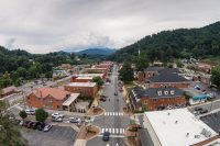
Landslide hazard maps axed by state: Risky slopes in Jackson, Haywood to remain a mystery for now
Republican lawmakers have pulled the plug on the state’s landslide mapping unit, terminating a controversial project to assess which slopes in the mountains are landslide prone.
A team of five state geologists working on the maps are being laid-off this week, saving the state $355,000 a year.
“They are very disappointed as we all are. We felt this was important work from the perspective of public safety that had a lot of value, and we are disappointed we couldn’t complete it,” said Rick Wooten, a senior state geologist and landslide expert based in Asheville.
When the team was created in 2005, their mission was to map landslide hazards in every mountain county. The team only finished four counties: Macon, Buncombe, Henderson and Watauga.
The unit was working on Jackson County when it halted in its tracks.
“I thought it was an added benefit and I was glad we were at the front end of it,” said Tom Massie, an advocate for landslide mapping in Jackson County who serves on the Mountain Resources Commission. “Anyone getting ready to buy a piece of property or build a home would know whether it was a suitable site. Now they are going to have to proceed at their own risk.”
Haywood County was next in line, but won’t being seeing its landslide maps either.
“I feel like we will be losing a valuable tool in the planning process for the land that is left to develop in Haywood County,” said Marc Pruett, an erosion control officer in Haywood County.
Landslide mapping has proven controversial, however. Critics fear the stigma of being in landslide hazard zones would make property hard to sell or develop.
“Certainly some of the legislators have been very open in their statements that they viewed these maps as a backdoor to regulation and were not the least bit sorry to see these maps go away,” said DJ Gerken, and Asheville-based attorney with the Southern Environmental Law Center.
That begs the question as to whether it was truly budget concerns and cost-savings that prompted lawmakers to target the landslide mapping. Indeed, environmental policies and funding have taken a big hit under the Republican controlled legislature. (See related story in Outdoors section.)
Rep. Mitch Gillespie, R-Marion, said landslide mapping was killed to save money — not because of an ideological stance.
“We had to make cuts throughout government this year and one of the areas that I didn’t feel like was a ‘have-to’ thing was the landslide mapping program,” Gillespie said.
But, Gillespie makes no bones about it: the state shouldn’t meddle in steep slope regulations. And Gillespie indeed feared the landslide maps would become ammunition to push through slope construction laws at the state level.
“That’s what they were doing it for,” Gillespie said of the landslide maps.
Sen. Jim Davis, R-Franklin, said he fielded a call from emergency responders in Haywood County — where several homes have been hit by landslides in the past decade — asking him not to cut the program. The landslide team was always one of the first on the scene when slides struck.
“Our role was to help out the emergency managers figure out what happened. Is it safe to work around here? Is there still unstable material up here? If there is, where might it go? Do we need to evacuate people? When is it safe to go back?” Wooten said.
If the state had plenty of money, Davis can’t say what the fate of the landslide mapping unit would have been.
“To be perfectly candid, I don’t know. That is a different conversation. Since we didn’t have the money we didn’t get to that conversation,” said Davis.
Good riddance
Not everyone is sad to see landslide maps fall by the wayside. Lamar Sprinkle, a surveyor in Macon County and a member of the planning board, said he feels like Macon is penalized as one of the four counties to have completed maps.
“As a property owner I would think if my property lay in one of these zones, it would devalue my property,” Sprinkle said.
Sprinkle said a prospective buyer from out of state would likely be turned off from property that falls in landslide zone, without knowing exactly what that meant.
“If I went down to the coast and there was some kind of red flag throwed up to me that I didn’t totally understand, I probably wouldn’t buy that piece of property,” Sprinkle said.
Sprinkle said he doesn’t understand how the maps were arrived at and is hesitant to take them at face value. He said the maps are a knee-jerk reaction to the Peek’s Creek tragedy. While a tragedy indeed, Sprinkle believes it was a random act of God. He sees landslide mapping as an arbitrary and fruitless endeavor that will do little to actually predict where a slide might hit in the future.
“There are some things we don’t have any control over,” Sprinkle said.
In wind storms, trees have fallen on homes, one even killing a couple inside.
“You don’t go passing an ordinance to make everybody cut the trees around their house,” Sprinkle said.
Ron Winecoff of ReMax Elite Realty in Franklin said Macon would be better off without the maps. He, too, fears it could devalue property.
Winecoff said Realtors in Macon have been confused over whether they are obligated to tell prospective buyers when property falls in the landslide hazard zone. Do the same rules apply as lead paint or asbestos? For now, the answer is no, supposedly.
“The state board of Realtors has told us we do not have to disclose it and so we don’t disclose it, but I don’t know whether that is right or not,” Winecoff said. “If you are aware of it, any item that effects the property adversely needs to be disclosed. Technically probably we should be disclosing those maps because they do exist.”
Critics of landslide mapping fear that property undeserving of such a label would be blacklisted and become impossible to sell.
More often that not, however, the landslide mapping would help people figure out where on a lot to put a house. Landslides follow predictable paths down the mountains, and building outside that path is usually all that is needed, say experts.
The path of a landslide is about 60 feet wide — about 30 feet to each side of the natural drainage course.
Gerken pointed to the Peek’s Creek disaster in Macon County, where 15 homes were destroyed in 2005. Those built closer to the drainage were flattened while those 10 yards to the side survived intact.
That’s why Pruett sees the landslide maps as a planning tool.
“If you had a chance to buy a piece of property and you knew where there might be a hazardous spot, wouldn’t you want to move your house 50 feet away from it? How could that not be helpful?” Pruett said.
There is, no doubt, some property in the mountains simply too steep, too unstable and too prone to landslides to build on — as unfortunate as that may be for the person who owns it and would like to sell it, Pruett said.
“Sometimes you just have to look a bear in the face and say it is a bear,” Pruett said.
But the landslide maps shouldn’t be blamed for pointing out the obvious.
While the homebuilders and real estate groups have actively lobbied against the landslide maps at the state level, not all developers are against them.
Ben Bergen, a builder in Jackson County and board member on the local Homebuilders Association, thinks the maps would have been a good tool.
“We would have liked to see it through to completion,” said Bergen, owner of the green building firm Legacy. “North Carolina is a buyer beware state in terms of property. I agree it is up to the buyer to inform themselves, but I thought it was going to very useful as a builder.”
At the very least, the maps would alert people to buy supplemental landslide insurance, Massie said. Regular homeowners insurance doesn’t cover landslides. Homeowners are out of luck — whether a home is totally flattened or the foundation destabilized due to shifting soil. They can’t sell their home, nor will insurance compensate them. Meanwhile, they have to keep paying the mortgage on a house they can’t live in. Often, bankruptcy and foreclosure become the only option.
The state has taken pity on some landslide victims and bailed them out. The state spent $3.2 million to buy out damaged areas of the Peek’s Creek slide in macon County.
Meanwhile, fixing a landslide in Maggie Valley cost the state and federal government a combined $1.4 million.
Gerken said the cost of landslide mapping would pay for itself by avoiding such disasters.
“It is an extremely affordable investment to avoid those costs,” Gerken said.
Gerken equated it to floodplain mapping, a long-standing practice that curtails building in flood-prone areas.
“Not because they happen every year, but it doesn’t make sense to build structures in an area that will likely get hit every hundred years,” Gerken said.
The maps aren’t exactly sweeping indictments of every steep mountainside. In Macon County, 11 percent of the county falls in the high landslide hazard zone. In Buncombe, its 10 percent, and just 6 percent in Henderson. Watauga comes in higher with 20 percent.
How to map a landslide
Unlike lightning, landslides nearly always strike in the same place twice. Mapping old slides is the single biggest indicator of where future slides will occur.
Many of the homes destroyed in slides over the past decade were built on top of old landslide deposits — something that landslide mapping could have warned people about, Wooten said.
“Some landslide deposits go back hundreds of thousands of years. They are usually quite large because they are an accumulation of many landslides that occur over geologic time,” Wooten said.
Wooten’s team has entered 3,000 old landslides in the state’s database so far. There are thousands more out there.
The mapping falls short of being able to predict the next slide, however.
“People say, ‘Well, where is it going to happen next time,’” Wooten said. “Eventually over geologic time it is going to reoccur.”
Geologists rely most heavily, however, on aerial photography over several decades to find evidence of slides, which remain visible for years.
In Jackson County, aerial photography from the early 1950s still revealed slides dating back to 1940, a fateful year when 13 inches of rain fell in 24 hours, triggering thousands of slides across the region.
Robbie Shelton, Jackson County’s erosion officer, was one of the team’s go-to consultants. He often acted as a guide, helping the team scout their way up mountainsides using locally known dirt roads and cart paths to reach an old slide.
After tagging along on the ground reconnaissance missions, Shelton knows what to look for and can hopefully warn builders and developers even though the county won’t have a complete map.
“I feel like I have a little better handle on it, having been out with Rick and his team, to be able to say, ‘This might not be the best place for you to think about building and you might want to consult a geotech,’” Shelton said.
The landslide unit has been working frantically to get the Jackson County maps to a good stopping point, and enter all the data they have so far into the database.
Wooten said he will drop off whatever GIS files they have done with Jackson County sometime next week, and then formally shut the books on the project.
While interesting, the half-finished map of where old landslides occurred is only somewhat helpful. The most important step — translating the location of old slides to identify low, moderate and high hazard zones — hasn’t been done.
While Wooten will remain employed as a state geologist and landslide expert, he won’t be finishing up the maps on his own.
“The message from the legislature was they do not want the mapping done,” Wooten said.
Putting the maps to work
So far, no county has banned building outright in high hazard landslide zones. What’s more likely is that landslide hazard zones will pinpoint where to impose regulations.
But of the four counties that were mapped, only Buncombe has actually done anything with them. In Henderson and Watauga, the landslide maps have found a cozy home on the shelf with no sign of being taken down anytime soon.
In Macon County, planners hope the landslide map will be incorporated into a new steep slope ordinance currently in the works. If passed by county commissioners, Macon will join just half a dozen WNC counties with slope ordinances — ranks that also include Haywood, Jackson and Buncombe.
Macon’s ordinance sets out a few simple parameters, like limiting the height and steepness of cut-and-fill slopes. On the steepest slopes, builders would have to consult an engineer.
And that’s where the landslide maps come in. Areas that fall in moderate to high landslide hazard zones would also require engineers to build on.
Wooten said that is a reasonable application for the landslide maps.
“If you were looking for a place to buy and the maps were available, you could see areas where there is a high landslide potential that would give you the information to seek additional help from geologists or engineers,” Wooten said.
But Sprinkle, who sits on the Macon planning board, doesn’t think the landslide maps have a place in the county’s ordinance, questioning their accuracy. And now that the landslide mapping team is dismantled, who can they call if they find an error in the maps, Sprinkle asked.
“There are lot of pitfalls in having maps with nobody to look after them,” Sprinkle said.
What’s next
While landslide mapping is gone for now, future lawmakers could start it back up. But a team will have to be re-assembled and the learning curve repeated.
“We paid to develop a lot of expertise in landslide mapping that we are now throwing to the wind,” Gerken said.
Landslide mapping gained traction following two back-to-back tropical storms that dumped a massive amount of rain on the mountains in 2005, triggering dozens of landslides. The most tragic was Peek’s Creek in Macon County, where five people, including a child, were killed and 15 homes destroyed.
“That was probably the event that got the attention of legislators,” Wooten said.
Gerken said the loss of life is inevitable without a more cautionary approach to siting homes.
“This short-term political decision simply cannot hold because we are going to see the consequences again,” Gerken said. “These kinds of events are part of mountain geology, and they will happen again. It is only a matter of time.”
See the maps online
To see Macon County’s landslide map, go to www.geology.enr.state.nc.us/Landslide_Info/MaconCounty.html. A partial map for Jackson will eventually be posted with a link at wfs.enr.state.nc.us/fist/.
Developer loses landmark lawsuit over shoddy roads
By most accounts, calling Art Williams a hands-on developer would be a pretty fair description. For decades, Williams was in the business of subdivision building, first in Florida and then in Western North Carolina.
In pretty much everything, his word was the final say. He picked the land to be developed, he divvied up the plots, he instructed engineers and construction crews. He even sold many of the lots himself.
Even as his health failed, said his wife Anne, her husband was routinely on the scene at the developments. His regular contractors said the same. He was there when the pavement was laid on the roads in Alarka Creek Properties, one of the Williams’ first developments in Swain County. And it was he who approved the words “state-approved paved roads” in brochures advertising the developments. He signed off on the erosion and sediment control plans for the 5.5 miles of roads that crisscross the development.
But it was not Williams who footed the bill when some of those roads began to deteriorate and slide from the mountains they were cut steeply into.
Of the homeowners in the subdivision, many bought their properties directly from Williams and believed the state-approved-roads pitch, until they were left with $40,000 worth of repairs and roads that were, in places, perpetually in peril.
This hadn’t been part of the purchase bargain. And in 2008, the costs and safety concerns reached a critical mass. The Alarka Creek Properties Homeowners Association took the late Williams’ Cane Creek Development Corporation to court, charging that he and his team misled them, saddling them with defective and dangerous roads.
Three years later, they won, to the tune of $3 million — the largest judgment court clerks had ever seen in Swain County — and threw into sharp relief the ongoing debate in Western North Carolina over steep-slope development and who is responsible when it falls, literally, to pieces.
What went wrong?
Alarka Creek Properties is a two-pronged development precisely 5 miles from Exit 69, just west of Bryson City. Its twin developments, Timber Creek Estates and Eagles’ Roost, sweep up the faces of neighboring mountainsides, cradling Alarka Creek neatly between them.
They’re not subdivisions in the traditional sense — there’s no pool or clubhouse, and most of the homes aren’t even within shouting distance of one another. They do have gates and a homeowners’ association, but really, the two developments are collections of retirement retreats and second homes, a mixture of already-built houses and empty plots that boast spectacular vistas of the surrounding landscapes.
The roads that lead to and connect them, though, aren’t for the faint of heart or fragile of vehicle. Sitting at the apex of Eagles’ Roost, facing down the mountain isn’t dissimilar to the slow crest of a rollercoaster’s first descent, peering down the long incline. They drop off steeply to one side and hug the sheer mountainside on the other. And though few cars are around to traverse the lanes, meeting one headed in the opposite direction can be a harrowing experience. The views are pastoral — the drive, less so.
The roads are anywhere from seven to 10 feet across. In places, there are signs of distress — fissures and cracking. They’re all passable now, but that hasn’t always been the case.
“We’ve had three multi-thousand dollar slides, we had a road that we had to move 2,000 feet of with blasting,” said John Foster, the homeowners’ association’s one-time president. “Ultimately, the road probably should not have been put in.”
That is, of course, only his opinion.
But, according to a study done by Bunnell-Lammons Engineering, a geotechnical firm out of Asheville, he’s at least partially correct.
There was never a dedicated, detailed road plan drawn up for Alarka Creek’s roads. Swain County doesn’t require one, and unless a developer plans on leaving the road in the state’s care, neither does the state.
There was, however, the required erosion and sediment control plan that detailed how the roads would meet state standards for erosion and run-off on the steep fill slopes — manmade grades with fill dirt pulled from the surrounding mountain.
It’s not a definitive road-building guide, but it spelled out the basic standards for what would be installed at Alarka Creek: road thickness, slope and drainage measures.
And, said the engineering firm, had developers and contractors followed the plans, the roads probably would’ve been fine.
But they didn’t.
Detailing the problems
There are, said the report, four basic reasons for mountain road failure: insufficient pavement thickness, insufficient asphalt compaction, slope instability and bad drainage.
In places, Alarka Creek’s roads showed all four.
Where the plans called for pavement to be two inches thick, in some spots it was only 1.5. They specified six inches of crushed stone under that pavement. Most roads averaged only 5.4. One had barely more than an inch.
Ninety-five to 96 percent compaction is industry standard for a fill slope — unlike the mountain’s native soil, it hasn’t had thousands of years to build up its structural integrity. The more densely packed, the less likely it’ll move around, cracking and sliding. That’s what the plans called for, too.
Most of the subdivision’s roads averaged between 84 and 89 percent compaction.
And then there’s the slope.
The state recommends a two-to-one, horizontal-to-vertical slope ratio at minimum for a safe road. And again, that’s what appeared on the erosion control plan submitted to the North Carolina Department of Natural Resources.
But the engineering firm found some of the slopes to be as steep as one-to-one.
“The roadway fill embankments evaluated have a significant potential for instability because the roadway fill embankments are constructed of loose fill that have a steeper slope inclination than fill soil conditions can support,” read the summary report.
In other words, you can’t have loose dirt and a steep road, too, or eventually, you won’t have a road.
“When you have slopes too steep and base and asphalt too thin, the roads are going to fall apart,” said Dan Bryson of Raleigh, the lead attorney on the homeowners’ side. The case, he said, was simple — poorly constructed roads sold through false advertising.
“When they showed homeowners paved road as an inducement to sell, it was a bait and switch,” said Bryson. “There was significant engineers’ testimony that these roads were not built pursuant to local standards. When you build a road, there’s just some basic things you have to do. And it’s going to take a little bit longer, but you just need to do it right.”
Anne Williams, Art Williams’ widow, disagrees with those assertions. As the sole owner of Cane Creek Development, she is the defendant.
Bryson and his legal team pointed to the multiple slides and alligator cracking — patchwork cracks that resemble the crusty reptilian pattern of an alligator’s back — as signs that the roads were faulty from the outset.
“But that’s typical of all roads in [Western] North Carolina, when you pave them,” said Williams. “All the other evidence was that we had done the right thing, we’d done the best roads we could do. State roads slide all the time, and 90 percent of that road is there the same way we built it.”
Could they have gotten a geotechnical engineer, like BLE, to come and test the sites before the road was laid? Sure, said Williams. But no developer does that, she said; it’s too cost prohibitive.
“You‘re selling lots to average people. This is not a country club setting,” said Williams. “We wanted to build in a way that the average person could buy and have a second home, not what we always called the ritzy ditzy.”
Plus, she said, they knew what they were getting.
“They all personally signed [a statement] that they understood that these were private roads and they were inferior to state roads and that the burden of keeping up the roads would be on the homeowners’ association,” said Williams.
And regardless of the roads’ initial construction, that much is true. Which points to a problem facing not just Swain County, but every mountainside subdivision in the region.
Caveat Emptor
Paul Carlson is a man familiar with degraded land. He’s the executive director of the Franklin-based Land Trust for the Little Tennessee, a non-profit group that works in land preservation. He is concerned about the glut of developments in WNC such as Alarka Creek, where steep lots connected by questionable roads have now fallen to owners to maintain. And those owners may not have always done their homework.
“Perhaps they hadn’t done significant due diligence to find out what they’re getting into, and now collectively own a liability,” said Carlson. And what then? “With poorly designed road systems on these properties, every year that passes the liability is increasing. Well, who’s going to be responsible for that stuff?”
That’s a question that legal precedents like the Alarka Creek case are looking to settle, but historically, a lot of homeowners have been left holding the bag on decaying roads they didn’t think they signed up for.
John Foster certainly didn’t. When he bought his plot in Alarka Creek, he didn’t dream Williams would sell him a lot on an unsafe road. But he didn’t look too far into it, either.
“I thought it was steep, but again with the advertisement of state-approved, I thought, ‘OK, if the state of North Carolina is going to approve this, then I’m OK with it,’” said Foster. “We did sign a release, but what we understood was we were going to maintain the roads, but we were going to be given roads that were maintainable.”
But this, of course, is not actually a given.
The truth is that, when it comes to private roads, no one is really checking.
During pre-trial interviews, lawyers asked that very question: is there anyone who makes sure these roads are being constructed properly? A state agency? Local authorities? A retired volunteer? Anyone?
“When you construct a house, you have an inspector come in and say ‘this house is substantially complete and it has been constructed in conformance with the plans and specs submitted on file’… to your knowledge, there is no one who does that for roads or private roads?” Bryson’s fellow attorney Scott Harris asked Victor Lofquist, a civil engineer in Sylva who did the erosion plan for Alarka Creek and most of Williams’ other projects.
“Not that I am aware of anywhere,” replied Lofquist.
Doug Parker, the excavator who helped install the roads, replied similarly.
“To my knowledge, there is no equivalent to that (a building inspector) on a road development project,” said Parker.
And that’s become pretty clear in the years since mountainside developments began to see their vogue.
Roads have been splintering and slipping off the hills in subdivisions around the region, and local officials began to realize that maybe someone should, in fact, be looking.
Road Regulation
Enter subdivision ordinances, those controversial local laws that give officials a little more power over what’s going up in their jurisdiction and how it’s built.
Haywood County has one that limits cut slopes to 1.5 to one, and spells out things that state erosion control standards do not, such as no organic matter in roadbeds; it will decompose and crack holes in the street. And they keep tabs to make sure it’s all being done according to plan.
“What would happen is if somebody built a subdivision road here that was subject to the erosion control law is you would submit your plan to us, we would give you approval, we would inspect it periodically. Then we do perform a final inspection,” said Marc Pruett, erosion control program director in Haywood County.
In Jackson County, a similar ordinance was passed, drawing some ire from developers in a locale heavy laden with second homes peppering the steep mountain faces.
But when it comes to such laws, there is a schism in the church of steep-slope construction.
Parker told attorneys in his deposition that those regulations helped grind his subdivision road-building work to a halt in Jackson County.
“We used to (build roads) a lot until we had a subdivision ordinance in this county and then it came to a stop,” said Parker. “Pretty much everything in this area that stopped developing because there was restraints of subdivision ordinances.”
Swain County has no such regulations. There was some movement on the idea around 2007. A committee was even formed, spurred by the news that emergency vehicles couldn’t traverse some of the county’s dicier residential roads. Recommendations were made, but nothing ever came of them. Swain commissioners apparently lacked the political will, in a county that doesn’t even have a planning board.
In neighboring Macon County, a so-called steep slope ordinance is in talks. Macon is dealing with the aftermath of the Wildflower development, which is the apocryphal, when-roads-attack story that seems to drift into most steep-slope conversations.
Wildflower was a behemoth of a development on the side of Cowee Mountain that broke ground in 2005, at the height of the mountain real estate upswing. At the time, it was controversial, but only because local residents feared such an influx of inhabitants would overstretch their resources.
Four years later, most of its lots were in foreclosure. Then the ground broke on it: One of its key thoroughfares collapsed, a landslide followed and a subsequent geological survey cast serious doubt on the rest of the roads in the place. Downslope residents were warned to brace for debris in case of extreme weather.
The neighborhood’s manager defended the roads, calling the collapse an isolated incident and pointing to the fact that the rest of the roads had erosion control approval.
But so, presumably, did the decimated road.
Finding solutions
Back on Alarka, the victorious homeowners are not yet rejoicing. Anne Williams maintains that she is an 81-year-old widow who had nothing to do with the roads’ construction and has no money to pay $3 million for their repairs. She said her refusal to settle with the homeowners wasn’t stubbornness, but insolvency.
“The fact is we lost on Alarka. We may have put in $3 million, but none of it came out of the profit. We have not had to pay income tax for profit reasons for at least five years, if not longer than that,” said Williams. She said she’s closed Cane Creek Development, laid off the staff and headed back to Florida to live off her Social Security.
Dan Bryson, however, thinks Williams’ cries of poormouth are, at best, disingenuous. He’s starting another proceeding against her that, in legalese, is called ‘piercing the veil.’ Basically, he’s going after all the other corporations she has, trying to draw some of the sizeable settlement from them.
In the rest of the region, though, the problem of unstable roads persists, though subdivision ordinances and the economy are cutting down on the number of new substandard streets going down.
Gordon Small, who works with the Haywood Waterway Association, is working on a project to help new developers find the most suitable road locations in the first place, rewarding them with a certification if they follow expert suggestions.
“The No.1 source of non-point pollution — or mud in the creek — is roads,” said Small. His group is trying to get county commissioners to get on board with the idea.
“You can’t observe this and not be concerned about that,” he said. “People are beginning to recognize that it’s to their advantage to know what’s going to move and what’s not.”
Carlson, with the Land Trust for the Little Tennessee, said he’s looking toward an inventory of the region’s perilous roads, so at least they can be monitored for movement.
“Clearly in [the last] decade up until 2008, it was absurd to try to make the argument that the highest and best use of steep-slope land was for forestry, but now it’s kind-of interesting to revisit the question,” said Carlson. “I think a lot of these lands — the most marginal, steep, remote lands where these roads were punched in — it may be that no one wants them.”
And for developers still around, the Swain County jury’s decision is ringing clearly through the mountains.
“I think these jurors are tired of developers who come in, deface the mountains and then put in substandard roads, sell out all the lots and then try to avoid liability,” said Dan Bryson. “I hope that this judgment sends a signal to every developer: if you pave a road on a mountain in Western North Carolina, it needs to be done properly.”
Homeowners in limbo as sides volley blame in Maggie landslide lawsuit
The latest filing in a lawsuit over the massive landslide in Maggie Valley last winter claims the collapse of the mountainside was triggered by a broken waterline at Ghost Town in the Sky amusement park. Until now, accusations centered on a failed retaining wall intended to shore up the slipping mountainside.
Landslide repair below Ghost Town set to begin
Stabilization of the landslide below Ghost Town in Maggie Valley will begin in two weeks, finally bringing comfort to downslope residents who have lived below the looming threat of another slide for half a year.
The slide last February scoured nearly a mile-long path down the mountainside with a wall of debris 30-feet high and 90-feet wide in places. Only three homes were damaged, but several others suffered destruction to their yards.
The slide initially forced an evacuation of a couple of dozen homes for fear more of the mountainside might collapse. To date, all but one homeowner, whose home suffered the most damage, has returned.
The $1.37 million job will take five months and was awarded this week to Phillips and Jordan, a construction company that specializes in major earth moving. The same company did the rockslide cleanup and stabilization on Interstate 40 last winter.
In addition to recontouring and shoring up the mountainside, the job includes road repairs and returning a dislocated creek to its original course down the mountain.
Al Hill, a seasonal resident with a second home below the slide, said he is pleased stabilization work will be done before the worst of winter. The freeze-thaw cycle can exacerbate erosion and act as a trigger for more landslides.
Engineers and slide specialists who have inspected the site cautioned that the slope remains unstable and another slide is still not out of the question. In fact, a slide could be triggered in the process of stabilizing the slope if the contractor isn’t careful.
As a result, a geotechnical engineer will work on-site each day with the Phillips and Jordan crew.
“It is extraordinarily sensitive,” said Randy Hintz, project manager with McGill Associates, an engineering and planning firm in Asheville overseeing the contract.
The geotech engineer will dictate the final outcome, but not necessarily the approach.
“There is a fine line in telling the contractor how to do his job,” Hintz said. “We tell them how the slope needs to be, and they figure out how to make that happen.”
If things start to look dicey, it might be necessary to send an alert to homeowners to leave the area, Hintz said. The engineer will not always be able to predict how the unstable slope will respond to a particular strategy when the contractors begin moving dirt.
Landslide experts and engineers believe the slide was triggered by a collapsed retaining wall on Ghost Town’s property. Ghost Town had struggled to shore up the unstable and nearly vertical slope on and off over the years.
When the mountaintop was leveled off to make way for the amusement park in the 1960s, loose dirt was pushed over the side of the mountain without being properly compacted. It must now be peeled back to reveal the original contour and compacted as it is put back. Portions of the slope, especially at the top, will be permanently recontoured at a gentler grade that mirrors the original mountainside, Hintz said.
Ghost Town CEO Steve Shiver originally objected to the stabilization plan and demanded an alternative design, but he did not get the engineering specifications done in time to go out to bid. Shiver said he is simply pleased work is getting underway.
“I am extremely happy,” Shiver said after the contract was awarded.
The total project, including engineering, will cost $1.47 million. Federal and state taxpayers will foot most of the bill. Maggie Valley taxpayers will contribute $25,000, and Ghost Town has pledged to contribute $25,000 as well.
Ghost Town has been in bankruptcy the past 18 months. Time is running out for the amusement park, which is being threatened with both foreclosure and liquidation. But Shiver remains hopeful a loan will come through allowing the park’s principal owner to regain title.
Meanwhile, Ray and Cookie Dye are tired of looking at a mud-filled pond that was buried when the slide moved across their yard. They want the pond dug out and their landscaping repaired, but it’s not clear who is accountable.
“We can’t prove it is [Ghost Town’s] fault,” Cookie Dye said.
Town Manager Tim Barth said town crews would try to dig out their pond for them.
Landslide repair down to the wire as competing plans play out
The clock is ticking for stabilization work on a landslide in Maggie Valley to get underway or a federal grant to pay for the work will be lost.
A $1.3 million grant to recontour the precarious mountainside near Ghost Town in the Sky amusement park was secured months ago from the Emergency Watershed Protection Program. But developing engineering plans, securing environmental permits and navigating the various state and federal agencies overseeing pieces of the work has taken months. The Emergency Watershed program has now granted a third — and final — extension for the stabilization work and set a deadline of Oct. 16.
“We need to be under construction by then,” said Town Manager Tim Barth. “They indicated this would be the last extension.”
The town is ready to go out to bid on the stabilization work, but Ghost Town does not like the design and instead has suggested an alternate plan. Engineering for the alternate plan is not yet finished, however.
Barth said the town cannot wait beyond Aug. 22 to go out to bid, or it will jeopardize getting construction underway by mid-October and in turn jeopardize the grant.
Without the grant, there is no source of money Barth knows of to stabilize the mountain. The town can’t afford the work, and the county has said it won’t put up money to fix a landslide on private property for fear of setting a bad precedent. Ghost Town, meanwhile, has been in bankruptcy for a year and a half and its ability to pay for the work is unclear.
The engineering firm, Bunnell-Lammons, has been waiting on some basic schematics from Ghost Town for several weeks in order to draw up a detailed engineering design for the alternate design. It will take two months for the project to be bid out, have a contractor selected, and for work to get underway.
“That’s why we are saying Ghost Town needs to really get it to them quickly,” Barth said.
Ghost Town CEO Steve Shiver said that there is “no problem” meeting the deadline to go out to bid. Ghost Town is delivering schematics on the alternate plan to the engineering firm this week. Shiver blames the town for plowing ahead with a plan that was “unacceptable” to Ghost Town.
“They composed the plan without any input from any property owners,” Shiver said. “If Mr. Barth would have engaged Ghost Town in the repair planning, we would already be under construction. I am frustrated that we are even put in this position by the city.”
The emergency federal grant requires support of the property owner. But Shiver said he would not agree to the first plan that was developed.
“Absolutely not,” Shiver said. Shiver said he told town officials so at the beginning of the process.
“He wasted two months worth of time. Why I have no idea why,” Shiver said. “The [engineering firm] was directed to come up with the plan absent any input from us.”
If the issue of dueling plans isn’t solved, it is unclear whether the town can compel Ghost Town to agree to the stabilization work. A state statute does allow towns to intervene if there is a threat to public safety.
“A city shall have authority to summarily remove, abate, or remedy everything in the city limits, or within one mile thereof, that is dangerous or prejudicial to the public health or public safety,” according to G.S. 160A-193.
The slide qualifies as a threat to public safety for the dozens of people living below the mountainside who would be in the path of another slide, according to N.C. Geologist Rick Wooten, who has assessed the destabilized mountainside.
“In my professional judgment, unstable slopes remain in the vicinity of the slope failure, and these unstable slopes present an imminent threat to public safety,” Wooten wrote in a letter to the Town of Maggie Valley following the slide.
Kim Hibbard, general counsel for the N.C. League of Municipalities, said the statute is most commonly used to force property owners to clean up junk cars, keep their lawns mowed or seal off old swimming pools.
But, “It is a fairly broadly written statute,” said Hibbard. Typically, the town would get a court order giving it permission to take charge of the public safety threat.
If the statute was used, the work could be billed to the property owner, in this case, Ghost Town. Although Ghost Town is in bankruptcy, the work carried out under the statute would have priority status, carrying the same weight as back property taxes, and would be the first thing to get paid off if the amusement park is either sold or liquidated.
Shiver said there are flaws in the original plan proffered by the town. For a start, it was unclear if there was enough grant money to cover the cost of the stabilization.
“There were too many variables in that plan. It had an open-ended checkbook,” Shiver said.
In addition, the original plan would claim a small flat area tucked into the side of the mountain that Shiver says is critical to the amusement park’s future plans. As the only level spot on an otherwise extremely steep slope, it’s one of the few places Ghost Town could add attractions in the future.
Ongoing issues foil Ghost Town reopening plans
The amusement park is still mired in bankruptcy and remains in a holding pattern until a major landslide blocking access to the park is cleaned up and stabilized.
A proposal by one of the park’s main owners to buy Ghost Town out of bankruptcy failed to go through as planned. Al Harper, owner of Great Smoky Mountains Railroad and a principal investor in Ghost Town, hoped to buy the park for $7 million. That price tag would fall $6 million short of covering the park’s debts, but it would have allowed the park to emerge from bankruptcy. Harper hoped to put the amusement park back in operation, but the deal was contingent on a loan from an offshore lender.
Maggie Valley business owners that rely on tourist traffic from the theme park had been hoping the deal would go through. But even if it had, the challenge of getting rides in working order to pass state inspections and hiring a seasonal staff to get the park open for the summer would have proved challenging, according to park officials.
Meanwhile, stabilization of a massive landslide that originated from the mountaintop amusement park is months away from completion. Until then, the risk of another even more massive slide is possible.
The work is estimated at $1.3 million, a tab being picked up by federal and state grants.
The town of Maggie is contributing $25,000 in matching funds and is coordinating the work. Ghost Town made a verbal promise to pitch in $25,000 as well. Maggie Town Manager Tim Barth said he won’t authorize work to start until the money from Ghost Town is in hand.
The town is still waiting on state environmental permits before the project can go out to bid. However, a debate has now emerged concerning competing plans.
Ghost Town CEO Steve Shiver is not satisfied with initial engineering plans to fix the slide.
“We thought there was a better way,” Shiver said.
The plan to recontour the mountainside on a gentler grade would claim a small flat area Shiver says may be critical to the amusement park’s future plans. As the only level spot on an otherwise extremely steep slope, it’s one of the few places Ghost Town could add attractions in the future.
As a result, Ghost Town asked for a second stabilization plan to be formulated. A slightly steeper grade, bolstered by a retaining wall, would preserve the level area.
Barth said Ghost Town must pick up the tab for engineering work required for the alternative plan, which is still in development. A cost estimate for the competing plan is not known yet, Barth said.
“If that option is significantly more expensive, that’s where more money might be necessary from Ghost Town,” Barth said.
Once one of the two plans is chosen, more detailed plans must be prepared before the project can go to bid.
Engineers still honing plan to stabilize remnants of Maggie landslide
Once repair work is complete, a precarious Maggie Valley mountainside destabilized by a major mudslide will be returned to its natural state.
The hard part will be getting to that point.
Last Wednesday, anxious residents downslope of the slide along with town leaders gathered to hear the plan of attack. Three engineers from McGill Associates and Bunnell-Lammons presented their preliminary reports, which recommend methods for both stabilizing the slope and restoring a displaced stream to its original path.
The top of the mountain was leveled more than 40 years ago to make way for Ghost Town in the Sky amusement park. Unwanted dirt was pushed over the side of the mountain in the process.
Engineers want to remove that fill soil and re-grade the slope to its natural state, peeling back the layers until they reach the contour of the original mountainside.
For now, it is unclear how exactly contractors will go about their work without setting off another slide, however. Town Manager Tim Barth said he is not sure who would be liable if another slide were to occur.
Without repair, however, a slide of the same or even greater magnitude than the last one could occur, according to Bunnell-Lammon, which is in charge of the slope stabilization part.
The state geologist earlier said up to 16,000 tons of loose material threatens the mountainside. Homes below have been left endangered ever since February’s slide, which left a 3,000 feet wake of destruction down the mountainside.
In engineering terms, a “factor of safety” of 1.0 or less indicates an “impending or active slope failure.” The upper portion of the slope now has a factor of safety of 0.6. Bunnell-Lammons recommends a minimum a factor of safety of 1.3, but preferably 1.5.
While the “how” of the plan is still being formulated, one thing is clear, use of major equipment will be minimal.
“Some of those jobs, it’s shovels and wheelbarrows,” said J.P. Johns, an engineer with McGill.
“This is not going to be a scenario where we get large pieces of equipment up there working around,” said Randy Hintz, project manager with McGill. “This is more likely going to be a situation where we have bobcats (small graders) and mini-excavators up there working.”
Red tape
The primary source of funding for the approximately $1.4 million project will come from a federal grant, while N.C. Department of Transportation will fund much of the rest. Meanwhile, Ghost Town and the Town of Maggie Valley say they will contribute $25,000 each.
All work will be supervised by qualified field specialists, who will be on site to approve even the most minor changes to the official plan. Contractors must be certified by the DOT and demonstrate a minimum of three similar jobs completed successfully.
Barth says he is hopeful it will take no longer than two to three months for the work to be completed once it begins.
McGill is waiting to receive necessary permits before it can hire a contractor to start work. The firm anticipates that a permit from the Department of Environment and Natural Resources could take up to 30 days.
Even after that, the DOT will require engineers to put the job out to bid for a minimum of 21 days.
That announcement left the crowd stunned at Wednesday’s meeting.
“That’s ridiculous,” someone whispered.
“Is there no way to expedite the 51 days you were talking about?” asked Mayor Roger McElroy. “That seems to me like an unreasonable time.”
Hintz responded that since North Carolina has not declared a state of emergency — like the town of Maggie Valley and Haywood County did in February — his firm has little choice but to follow the normal protocol for publicly-funded jobs.
“In order to get the state funds to participate in this project, it must go through all the same channels,” said Hintz, while reassuring residents that the project has moved forward since February. “We’ve accomplished an awful lot at this point.”
Resident Kurt Biedler asked specifically if debris would be removed from his house, one of the five worst damaged by the slide.
“I mean these are things that are very important to me right now: trees, rocks, guardrails, timber,” said Biedler, who has moved to Arden for now.
Hintz said he would have to check with the funding agency before he could answer. “We have been given a very narrow focus on the types of things we can spend this money on,” said Hintz.
As part of the stabilization process, a road on Ghost Town’s property that sits on top of the fill dirt will be dismantled. The road is key to getting from one part of the amusement park to another. It will not be rebuilt by contractors working on the project.
According to Bunnell-Lammons, it appears the landslide started at Ghost Town’ retaining wall, where the fill soil placed with the MSE walls met underlying residual soil. Those MSE walls will be removed as part of the repair process.
Bunnell-Lammons stated in its report that it had been specifically directed not to determine the cause of the slide or evaluate the parties responsible for the slide.
“Our scope of work is how to immediately repair it,” said Will Gentry, a Bunnell-Lammons engineer. “We have not gone into why did it fail and how did it fail.”
Creek restoration
Meanwhile, mud, downed trees, and other debris have stopped up culverts where the creek crossed Rich Cove Road three times on its way down the mountain. The landslide also created a wide, long swath now prone to erosion.
To restore the stream, McGill’s plan recommends removing mud, downed trees, and other debris from three culvert crossings along Rich Cove Road. Currently, the blocked up culverts are forcing the stream to divert from its natural path.
Contractors will work upstream to downstream in the upper section, then downstream to upstream in the lower portion in order to work “dry.”
The removed trees would be ground up into wood mulch, which will be spread out on the mountain slope. This will minimize how much material contractors have to deliver up the steep slope.
“We’re going to try to limit the hauling out and the hauling in,” said Johns.
“Speed bumps,” made of mulch will be installed to slow down water as it flows down the slope.
Vegetation will be re-established with native species as much as possible, though a true restoration will be difficult to accomplish with the limited funding that’s available.
The first priority, however, will be to address the unstable slope at the top of the mountain.
“We don’t want to do any work down below until we get the top stabilized,” said J.P. Johns, an engineer with McGill.
Maggie slide victims still living in limbo
More than three months have come and gone since a major mudslide crashed through Maggie Valley’s Rich Cove community, and slide victims are still wondering when a cleanup will finally begin.
Their properties are not much better off since the Feb. 5 landslide occurred, with enormous boulders, splintered trees and muddy debris still cluttering yards. Some residents with ruined drinking wells continue to suffer lack of access to water.
Then, there’s the 12,000 to 16,000 tons of loose material hanging over their heads at the top of the mountain.
For now, these homeowners have little recourse. Their homeowner’s insurance does not cover landslides, and Ghost Town amusement park — where the slide originated — is still mired in bankruptcy and had no liability insurance at the time of slide.
While a federal grant has been devoted to fix the dangerously unstable mountainside, no state or federal funds have been dedicated to repair homes and private property. The grant will do little to help residents whose driveways are busted, drinking wells ruined or homes rendered unlivable.
Many slide victims have flocked to town hall for the twice-monthly updates from Town Manager Tim Barth, but their questions seem to outnumber the answers currently available.
About 16 concerned citizens came to the latest meeting last Wednesday (May 5) when Barth informed them that a plan for stabilizing the mountain and cleaning up debris that threaten the nearby stream may be in place by next week.
Most of the $1.4 million project will be funded by a federal grant, while the Department of Transportation will fund much of the 25 percent local match, as the slide impacted state-maintained Rich Cove Road. The Town of Maggie Valley and Ghost Town have contributed $25,000 each toward that 25 percent match as well.
Resident Ike Isenhour said the residents in Rich Cove just don’t have the funds to chase Ghost Town with lawyers to receive compensation for the damage to their property.
“If you’re poor folk, and you’re living paycheck to paycheck, then you have no recourse,” said Isenhour.
Isenhour’s driveway on Landing Drive was taken out by the landslide, and though volunteers have installed a temporary fix, he’s now in need of a more permanent solution.
A few thousand dollars worth of gravel would be a mere drop in the bucket but would help his family immensely, Isenhour said.
Meanwhile, Isenhour’s neighbors still have no access to water, and have run a hose to a relative’s house nearby, where they often fill up bucketfuls of water to bring back home to flush their toilets. The situation has remained unchanged since the mudslide occurred, though warmer weather means the water running through the hose no longer freezes as it did this winter.
Barth responded that the federal Emergency Watershed Protection grant is not designed to do work on private property.
“Things like digging somebody a new well, I don’t believe would be a qualifying expense under this grant,” said Barth.
The solution may lie with private citizens once again. The Greater Maggie Valley Natural Disaster Team, which involves a slew of churches, businesses and private citizens devoted to helping those affected by natural disaster, helped slide victims in February and are exploring ways to continue assistance.
Erma Bond, assistant pastor at the Maggie Valley United Methodist Church and part of the disaster team, regularly attends the semi-monthly meetings at town hall.
Bond and her team have discussed the possibility of helping residents regain a water supply many times without yet coming to an agreement.
“If we helped the ones that had the water problem, then what are we going to do for the others?” said Bond.
It may be best to donate a collective disaster relief fund to the town to prioritize, Bond said.
Stabilization to begin soon
Two engineering firms have been commissioned for $125,000 using money from the federal Emergency Watershed Protection grant.
McGill Associates will coordinate stream restoration and debris removal, while Bunnell-Lammons, a geotechnical engineering firm based in Greenville, S.C., will determine how exactly to stabilize the slope.
Eager contractors have already begun contacting the companies expressing interest in taking on the work, but Barth said they must undergo a thorough vetting process to ensure they are qualified and experienced.
“Someone who has a small backhoe and a dump truck cannot go up and do this work,” said Barth.
State Geologist Rick Wooten said the earth continues to shift beneath Ghost Town in the Sky, a mountaintop amusement park where the slide originated from behind a series of terraced retaining walls.
On May 3, Wooten traveled to the top of the mountain once more to measure a scarp in the pavement. Wooten said his measurements show land there has moved down 4.8 inches vertically, and horizontal displacement has occurred as well — meaning the slope is moving both downward and outward.
Wooten is not alarmed by the slight creep, however.
“It’s nothing dramatic,” said Wooten.
With the rainy season upon us, however, Maggie Valley resident Deborah Reynolds asked Barth if any preventative actions could be taken before work officially begins to stabilize the mountain.
“Is there any type of measure they can go ahead with so that people can at least feel safe?” asked Reynolds.
“Someone needs to make sure they go up there every time it rains,” added Resident Denise Sutton.
Barth said the town might take action if rainfall exceeds five inches, but with the only road to the top of the mountain still largely impassable, it’d be difficult to do much work now.
Town steps in
The town hall meetings Barth conducts run fairly casually, with residents candidly discussing what they’ve read in the paper this week, expressing their ongoing concerns and asking questions informally. Many of the questions revolved around Ghost Town, which may emerge from bankruptcy soon with a new owner, Al Harper. (see story on page 6).
But Barth was unable to shed much light on Ghost Town’s plans.
“I wouldn’t know Mr. Harper if I ran into him,” Barth replied.
Residents were miffed at the lack of communication from Ghost Town.
“Nobody hasn’t come talk to us,” said resident Tammy Rich. “We haven’t seen a soul. We still don’t have any water.”
“He says they’re going to open in July,” said Resident Betty Miner. “What a laugh.”
Resident Jane Simpson asked if the town could prevent Ghost Town from opening until the stabilization is complete.
“I don’t know if they can open or not,” said Barth. “But if their customers come to me and say ‘Is it safe to go up there?’ I’m going to say ‘No.’”
According to Isenhour, there is too much focus is on getting Ghost Town back open for the summer season rather than helping impacted residents. Barth said the town’s main focus is to see the mountain stabilized and safe, not to help Ghost Town reopen.
Though the Rich Cove community lies in both town and county territory, town leaders have spearheaded the cleanup effort, tracking down funding for the cleanup and keeping residents in the loop with the regular meetings.
Miner said she’s grateful to the town for holding the semi-monthly meetings but would like to see an engineer or geologist familiar with the efforts inform residents about their findings.
Barth said he was planning to do so once more specific plans are in place.
“It doesn’t make sense for the engineers to come before they complete their report,” said Barth.
Ghost Town owner Harper daunted but not deterred
As Al Harper watched the national recession undermine ticket sales at Ghost Town amusement park over the past two years, he faced a tough choice: pump more money into the faltering theme park or throw in the towel?
Walking away would mean losing the millions he already invested. But investing more could mean throwing good money after bad, with no hope of recouping any of it at the end of the day.
Harper ultimately drew his inspiration from a favorite historical visionary.
“It is kind of fun to do the impossible,” Harper said, quoting the words of Walt Disney, which are inscribed on a plaque he keeps on his desk.
Harper, the 65-year-old owner of the Great Smoky Mountains Railroad and scenic rail lines in Colorado and Texas, wants to revive the bankrupt and beleaguered Maggie Valley theme park.
Harper has been a major backer of Ghost Town since 2006, but he shared ownership with other partners and investors. Under Harper’s rescue plan, he will pay off $7 million of the park’s $13 million in debt — and emerge as the sole owner of the park in exchange.
The host of other investors will be cut out and their equity in the park simply evaporate.
“I have lost a lot of money. You have no idea,” said Steve Nichols, an investor from Orlando. “It totally ruined my life.”
Harper will also walk away from more than $5 million in back debt — including hundreds of thousands owed to local businesses, from electricians and plumbers to gas companies and media outlets — which will be wiped away by the bankruptcy court.
Despite the financial carnage in its wake, Ghost Town would avoid the uncertain fate of foreclosure and emerge from bankruptcy with a leader at the helm determined to resurrect the Old West theme park.
“I believe if there is anybody that can pull it off and can keep it as a theme park it is me,” Harper said.
To fund the deal, Harper has lined up a loan with an offshore lender. He said he is “90 percent positive” the loan will come through, hopefully by early June. The Greek financial crisis has come at a bad time, however, and Harper hopes it doesn’t make the lenders nervous.
Harper is putting up the Great Smoky Mountains Railroad as collateral, pledging 100 percent of the railroad’s ownership in exchange for a $15 million loan.
“I am gambling my railroad,” Harper said.
Half the money would be used to buy the park out of bankruptcy, and the other half would sustain operations and bankroll improvements to the park until it begins turning a profit. Harper has built in losses for the first three years, though he hopes to turn it around quicker.
The plan has been approved by the bankruptcy court. All the deal waits on now is the loan to close.
When Ghost Town was put up for sale several years ago, Harper was courted by tourism leaders in the region. Harper originally hoped to be a silent partner with a limited investment.
But the other two partners were unable to raise the cash they promised, and Harper was being pressured to put up more money, he said.
“Right at the beginning they were $2 million short. They said ‘Would you co-sign with us?’” Harper said.
The pattern continued over the next two years as the park struggled to get off the ground and stay afloat.
“I didn’t want to lose the $2 million, so I put in more,” Harper said.
Similar cash calls went out to all the shareholders and investors, but Harper’s deeper pockets left him as the last man standing when the need arose to pitch in more, he said.
Harper ultimately found himself in for more than $4.5 million in loan guarantees — which he is now on the hook for if the park goes under. It’s partly what motivated his plan to buy the park out of bankruptcy.
“Here are my choices. I can forget Ghost Town and write a check for $4.5 million and never look back. Or I can go in and try in this crazy economy to buy Ghost Town,” Harper said. “The easy way out is to walk.
“But this is a lot deeper than that,” said Harper. “My name got attached to it.”
A lot to lose
Several Maggie business leaders are among the ranks of those who will lose shares in the park, but those interviewed for an article last week don’t see their investments as being for naught. As long as Ghost Town continues to operate and bring in tourists, they believe their contribution helped the greater community, even if they personally have nothing to show for it.
A handful of investors from out of state who put up capital for the park’s purchase in 2006 are not feeling so rosy by what they see as an end-run by Harper. But they are helpless to do anything about it.
“I don’t think there is anything I can do other than write it off as a bad investment,” said Court Huish, an investor from California. “That’s just business.”
Jeff Anderson, an investor from Florida, will lose a substantial six-figure investment.
“I am not happy with what has transpired, but it is what it is. The bankruptcy court is the bankruptcy court,” Anderson said.
Nichols not only stands to lose his six-figure investment as a shareholder, but he is also on the hook for a portion of the park’s mortgage, a portion of which he personally guaranteed.
Ghost Town took out a loan of $9.5 million with BB&T in 2006. Harper’s deal will only pay off $7 million — leaving BB&T short by $2.5 million. Naturally, BB&T is coming after Nichols to make good on the portion he signed a personal guarantee for. Nichols wouldn’t say for just how much.
“The nail is in the coffin. They may as well throw the dirt on,” Nichols said.
Nichols said the owners kept returning to investors asking them to put up more to keep the park afloat, but he didn’t have any more.
“It’s not that we don’t care,” Nichols said. “I think Ghost Town is a wonderful place, but if you haven’t got the money you haven’t got the money.”
Besides, the shareholders weren’t given a say in park operations, like the large amount of the money spent on upgrades the first two years after reopening. The 1960s-era amusement park was plagued by crumbling infrastructure, from a jury-rigged electrical system to malfunctioning rides. Putting the park in order required a “big capital burn” and dug a hole it couldn’t emerge from, Nichols said.
“I think they tried to fix too many things too fast instead of little by little,” Nichols said.
Anderson agreed, to a point.
“To suggest the sole reason for the failure of the park to perform was because of the capital over-expenditure is ridiculous. As with everything that fails, there is not one reason, there is multiple,” Anderson said.
Nichols said the park has the potential to make money, but luring visitors was ultimately the main challenge.
“If you don’t have enough people coming, what are you going to do? It’s Business 101,” Nichols said.
Particularly in the days of Six Flags, Busch Gardens and Carowinds.
“That stuff wasn’t there back in the 1970s,” Nichols said.
Harper estimates it will take 150,000 visitors a year to make the park profitable. It brought in just 71,000 last year while suffering from the negative publicity of bankruptcy and spending no money on advertising.
As a sole owner, Harper said he will have the control he needs to make the park work — control he didn’t have under the old entity. Harper points to his success with the Great Smoky Mountains Railroad, even during the recession.
“My worst year ever I put 150,000 people on a train,” Harper said. Harper plans to cross-market with the railroad to send visitors Ghost Town’s way. He will also combine functions like payroll, accounting and ticket sales, saving hundreds of thousands, he said.
Huish, Nichols and Anderson say they were not properly kept apprised of unfolding events, like Harper’s bid to buy the park.
All three were all brought to the table as investors by Hank Woodburn, one of the lead buyers in 2006. Woodburn comes from the amusement industry, operating a network of 10 fun parks with water parks, mini golf, laser tag, go-carts and the like under the company Adventure Landing. Woodburn also recruited Harper to the deal.
Woodburn, who will lose substantially in the deal, did not return messages.
Moving on
Harper doesn’t see his deal as ruthless. The alternative was foreclosure, and under that scenario, the investors would likewise lose all their money and the small businesses still would go unpaid. Under Harper’s plan, at least Ghost Town has a shot at staying an amusement park.
Harper could theoretically use part of the $15 million loan he is taking out to pay back those left holding the bag. But divesting the park of its old debt is key to Harper’s business plan.
“I can’t pay for all the mistakes that happened in the past,” Harper said. “It is a tragedy that it ended up like it ended up.”
Harper said he is not exactly a winner in whole deal. He’s taking on a major new venture at the age of 65 — a defensive but risky strategy to protect the investment he already sunk into the park. In addition to the $7 million Harper will pay for the BB&T bank mortgage, he is on the hook for $2 million on an outside loan to fund improvements at the park that he co-signed for — which must be paid separately.
“I could take the approach I was a victim. But the world is full of victims,” Harper said. “I made mistakes, so I am going to correct them. I am going to make this thing work. We have got to move forward and get this past behind us.”
Getting the park open
A deal to bail Ghost Town out of bankruptcy court is contingent on a loan from an offshore lender.
If it goes through, the park could be open by the beginning of July, according to Ghost Town’s CEO Steve Shiver. Shiver told a group of business owners last week that there is a lot to do to get the park open for the season. Once the loan comes through, work can begin.
Workers must be hired and trained to run the park, but the biggest challenge will be getting the grounds, rides and facilities ready. Shiver laid out a long list of needed repairs, including replacing water pipes that froze and broke over the winter and two broken water pumps that move water around the mountaintop. Winter even took its toll on the rides, some of which need retrofitting now, Shiver said. The major rollercoaster, which opened only for a short time last season, has inspection hurdles to pass once more.
One issue to contend with will be nearly $400,000 in debt from 2009. The long list includes paying off at least $30,000 in utility bills from 2009 to get water and power restored.
It is also unclear whether the park could reopen until the mountainside below, which was destabilized by a mudslide, is shored up.
Ghost Town liability insurance lapsed prior to Feb. 5 mudslide
Ghost Town in the Sky failed to make timely payments on its liability insurance policy, and as a result it lapsed just days before a massive mudslide originating from the theme park wreaked havoc on the mountainside below.
Now, property owners downhill of the mudslide whose homes were damaged may have no recourse to pay for repairs to their homes.
It is unwelcome news, although not surprising, to Kurt Biedler, a homeowner in the path of the slide whose home is now unlivable.
“We are victims of shabby business,” Biedler said. “Ghost Town is the Sky has effectively turned my life upside down and it is a very difficult thing for anyone to put with. It is not an easy thing knowing that a company, whether it is bankrupt or not, has been allowed to pull the shenanigans they have.”
Biedler and his wife have a mortgage on a house that has been destroyed. They say they are innocent victims with no clear or obvious path for recourse. But that isn’t going to stop Biedler from trying.
“We are still exploring our options of what we are going to do. There are always options,” Biedler said.
Ghost Town CEO Steve Shiver and others knew almost a year before the mudslide that the mountain was unstable. Ghost Town hired an engineer to examine the slumping portion of the mountainside in early 2009. The report calls into question the structural integrity of a massive series of retaining walls holding back a section of the mountainside that had proved troublesome on and off for 30 years.
“The MSE wall is not functioning as intended at this time and structural failure of the wall is possible if not replaced,” the report by Haywood County engineer Pat Burgin states.
The report was made in March 2009. However, Ghost Town owners failed to alert anyone of the potential danger — not the town, county, emergency agencies or homeowners living below.
Insurance saga
Ghost Town was three months behind in liability insurance payments when a cancelation was issued on Jan. 28.
The mudslide happened on Feb. 5. Five days later, on Feb. 10, Ghost Town wired $27,400 to cover the past due bill. Insurance was reinstated, but it was too late to cover damages stemming from the mudslide, the insurance company contends.
The insurance company, First Mercury Insurance, has been contacted by three homeowners suffering damage in the mudslide, according to the company. But First Mercury says it will not cover the claims, citing a lapse of Ghost Town’s liability insurance policy at the time of the slide.
“Some homes were in the direct path of the landslide and certain homeowners appear to be pursuing claims against Ghost Town for damages,” an attorney for First Mercury wrote in a federal bankruptcy court filing. “First Mercury contends that it has no duty to defend or indemnify any claims that may arise from the landslide because the policy was cancelled prior to the landslide, and therefore does not afford any coverage.”
Homeowners could redirect their claims and lodge them against Ghost Town directly instead of the insurance company, but First Mercury admits in the court filing that route could be futile, stating there is “little to no likelihood of recovering anything from (Ghost Town) itself.”
Ghost Town has been in federal bankruptcy court for more than a year. This week, Ghost Town brokered a deal to sell the amusement park to one of its current owners, but under a new corporate entity — walking away from several million in debt in the process and starting over with a clean slate.
The former corporate entity of Ghost Town may cease to exist once the new corporate structure takes over. The new entity, while comprised of the same major player, may not be responsible for claims against the old corporate entity.
It’s the same principle that allows the amusement park to leave behind millions in unpaid debt while the primary owner remains at the helm.
First Mercury Insurance points out in its court filings that Ghost Town may not be liable for damage claims anyway. Lawsuits would have to hash out whether Ghost Town is at fault for the slide before the insurance company would have forked over damages under the policy, even if it was valid.
When The Smoky Mountain News first reported on Ghost Town’s insurance lapse two months ago, Ghost Town partners insisted their coverage had never lapsed. Failure to keep insurance current is a violation of bankruptcy rules.
Ghost Town has not filed a response to the court filing of First Mercury outlining issues with the insurance coverage.