The value of a view: Thousands of acres added to the Parkway for Park Service centennial
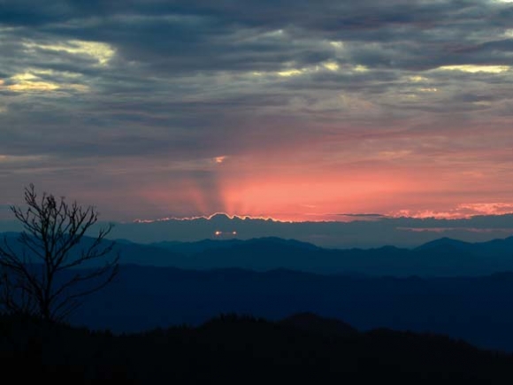
It’s not unusual for Waterrock Knob, which boasts some of the best views on the Blue Ridge Parkway, to see its parking lot test the limits as summer reaches its zenith. More people visit the Parkway than any of the 412 units in the National Park Service, and it’s hard to resist Waterrock’s high-elevation coolness and sweeping vistas when mid-year heat grips the valleys below.
But while the volume may not have been unusual, the crowd gathered on the visitor center lawn last week represented something far different than the typical throng of tourists. Comprising more than 100 people, the audience of Park Service employees, conservation advocates and local government officials had come together to celebrate one of the most significant conservation projects in Parkway history on one of the most significant weeks in Park Service history — that of the National Park Service’s 100th birthday.
“I can’t imagine a more fitting way to celebrate the centennial of the National Park Service than to celebrate this conservation achievement,” Parkway Superintendent Mark Woods told the crowd on Aug. 23.
The achievement in question — adding 5,329 acres surrounding Waterrock Knob to the Park Service — had been years in the making, involving a miles-long laundry list of conservation organizations, government entities, grants and private donors. But the process was winding to a close, with the newly dedicated Waterrock Knob Park promising another 100 years of Parkway vistas and backcountry adventure to the area.
“It has been literally 60 years since a transaction this large has taken place adding land to the Blue Ridge Parkway,” said Mike Leonard, chairman of The Conservation Fund. “This is an incredible thing.”
At 469 miles in length, the Parkway traverses some of the most scenic portions of the Blue Ridge Mountains, its many overlooks inviting visitors to pore over mile after mile of mountain views. But for most of its journey, the Parkway is bordered by only a very thin swath of Park Service land, meaning protections for the rare habitats through which it passes and the views it showcases often end not too far from the pavement. Visitors can be hard-pressed to find a trail that gets them distant enough away from the road to escape the sound of revving motors.
Related Items

Blue Ridge Parkway license plate sales top $570,000

Camping fee increase proposed for Parkway

Blue Ridge Parkway bridge nears completion

Wander through winter
Further north on the Parkway, where national forest land isn’t as abundant as in Western North Carolina, overlooks are sometimes better places to view subdivisions than to gaze at forested mountains.
That’s why the Park Service sees the establishment of large-acreage parks at intervals around the Parkway as integral to preserving the route’s character. In North Carolina, three such parks exist — Moses H. Cone Memorial Park and Julian Price Park near Blowing Rock and Doughton Park near Laurel Springs. Waterrock Knob will now have its own part to play in that mosaic.
“I don’t know where to begin to address the significance of the land conveyance and its importance to the Parkway and surrounding region,” said Rusty Painter, director of land protection for The Conservation Trust for North Carolina. “It’s tremendous.”
“It’s very important to the scenic protection of the Blue Ridge Parkway,” agreed Bill Holman, director of The Conservation Fund. “The land base around Waterrock will provide more recreational opportunities for the public, and I think water quality protection is very important.”
Reaching the finish line
Getting the land officially conserved is cause for celebration, but it was a long road to reach the milestone — and it’s not a road that’s completely traveled yet.
“It’s been a lot of hard work,” Leonard said. “I’ve been working on this since about 2011, off and on.”
The Conservation Fund is responsible for the largest share of the 5,000-plus acre area, purchasing 2,986 of those acres in stages beginning in 2012. Land conservation projects tend to move slowly, involving all the trappings of a real estate deal along with seeking out grants, jockeying for private funding and negotiating contracts to stipulate what kind of development can and cannot occur on the property following the sale.
“At some point in this as it went along I realized, ‘Oh, if we time this right we can have it come to fruition in connection with the 100th anniversary of the National Park Service,’” Leonard said.
As the date drew closer, the centennial goal became an argument for making the legal work move faster. And Leonard made the deadline, with the property from The Conservation Fund officially becoming Park Service land the week before the centennial date.
But there are still plenty of dotted lines to sign, because The Conservation Fund is far from being the only organization involved in creating Waterrock Knob Park. In addition to The Conservation Fund property, the land conveyance involves 1,654 acres from The Nature Conservancy, 319 acres from the Southern Appalachians Highlands Conservancy and 370 acres from The Conservation Trust for North Carolina. That land isn’t officially Park Service property yet, but the process is expected to be complete within the next year, with most land conveyance complete by the end of 2016.
“Even donations to the federal government can take a long time, but we’re confident that the momentum created by this event, the new park and the 100th anniversary of NPS will allow us to move quickly,” Painter said.
Overall, conserving the 5,000-plus acres cost $16.9 million, $14.3 million of which was private funding — the Stanback family contributed a significant chunk of that. The remaining $2.6 million was public money, a grant from the federally funded Land and Water Conservation Fund. Having that grant funding in place, Holman said, allowed the conservation organizations to convince private donors that this was a cause with enough momentum to make it worth getting behind.
“That’s good leverage,” Holman said. “That’s a good investment for the citizens of the United States.”
A worthwhile investment
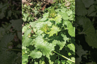
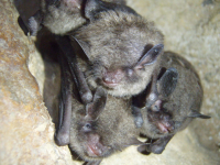
All it takes is a quick look around to see why the peaks and ridges surrounding Waterrock might be a worthy investment for the future generations the Park Service is charged with serving. The slopes are steep and rugged, some of the highest in the region. Spruce-fir forest covers much of the land, a habitat type that’s rare this far south, occurring at only the highest elevations. The endangered Carolina northern flying squirrel lives there, as do several rare bat species and the pink shell azalea, which is native only to high-elevation habitats in North Carolina. Now that the land is coming into Park Service possession, Parkway staff can be turned loose to discover what other prized species might make their homes there.
“This is one of the richest areas in terms of habitat anywhere on the globe, so we know there will be incredible species identified, and maybe new species to science — you never know,” Woods said. “The diversity of the habitat is just incredible in this area.”
There are also the elk to think about, a population that’s been spreading and multiplying since 2001, when the species was reintroduced following centuries of absence from the region. The preserved acreage will serve as a corridor for elk to travel as they range the mountains, traveling between feeding grounds. While much of the preserved land is of the wooded, old-forest type unlikely to yield huge quantities of the foods elk like, Holman can think of at least one popular elk feeding ground within the boundaries — Old Field Top, a plot that’s in the valley between Mount Lynn Lowery and Plott Balsam.
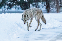
Deer, bear and other wildlife call the tract home as well, and brook trout swim Campbell Creek as it tumbles down the mountain.
There are plenty of people, too, who find quality habitat on the mountainsides — many of them already enjoy some of the not-quite-official trails that spider through the area. Spots such as panoramic Blackrock are included within the boundaries of Waterrock Knob Park — the Parkway’s planning process will take a look at where new trails could be put in or how existing trails could be upgraded to meet Park Service standards.
Planning a park
Trails will likely be the only kind of development to take place on the new acreage. The land is so rugged, Leonard said, “it would be hugely expensive to do anything else.”
The Parkway’s management plan, adopted in 2012, supports that prediction.
“The park lands adjacent to Waterrock Knob during that planning process were identified as a ‘Special Natural Resources Zone,’ given the unique and sensitive habitats in that area,” said Parkway spokesperson Leesa Brandon. “The newly acquired lands will likely be similarly managed.”
According to the plan, management of areas within the Special Natural Resources Zone should emphasize “the highest level of protection of sensitive habitats,” with visitor use kept very low or even completely closed off in especially fragile areas. Management would focus on restoring rare habitats and recovering or reintroducing rare species, shying away from extremely visible forms of forest management. For the most part, the plan says, visitors experience these areas as part of a distant view rather than up close — unless they opt to venture into the backcountry.
“Visitors would require a moderate to high level of skill, self-reliance and effort to access these areas,” the plan reads.
Locals already know that hiking the Plott Balsams is no easy feat, with high levels of difficulty as well as beauty. The 2.2-mile route to Blackrock, for example, is full of ups and downs and rock scrambles and narrow ridgeline channels, demanding that hikers prove their mettle to reach the breathtaking 360-degree view at the end.
However, developing the area will involve a lot more than just slapping a National Park Service sign at the beginning of existing trails. The Blackrock trail, for instance, sees little use now. But its steep uphills and path through environmentally sensitive areas would become problematic if the full pressure of the Parkway’s 15 million yearly visitors bore down on it. It would take a lot of money and labor and expertise to get a trail like that up to Park Service standards.
Details such as which trail should go where and who can use them and when they’ll be built, however, won’t be pinned down for some time. The next hurdle is to get all the land officially into Park Service possession. From there, the task will be to get the boundaries marked off and park staff familiar with the topography now in their jurisdiction.
“Protecting the land’s pristine condition and ecological integrity will guide the Parkway’s management of these areas,” Brandon said. Conversation has begun about how the land might be used, but the formal planning process has not started, and Brandon could not say what steps the process might entail.
However, one consideration going forward could be evaluating how a trail network might connect Waterrock Knob Park to other public parcels abutting the acreage. For instance, Sylva’s Pinnacle Park backs up against the land now owned by the Southern Appalachian Highlands Conservancy and The Nature Conservancy — there’s an existing trail that connects Blackrock to Pinnacle Park’s trailhead on Fisher Creek Road. The Maggie Valley Watershed borders the Parkway’s other side, as does the Haywood Community College Learning Forest. And the Conservation Fund is currently working on a few other land conservation projects nearby, which could add to the contiguous acreage of public land in the area. It’s important to think about how those lands could be considered together to jointly create an invaluable resource for the region, Holman said.
“I think a trail system that would connect Sylva and Pinnacle Park to Waterrock Knob and have connections also into Maggie Valley and into Waynesville and into Cherokee would be a huge draw for outdoor enthusiasts from all over the country,” Holman said.
In the future, maybe that would be possible. And looking ahead to the next 100 years of life with the National Park Service, there is plenty of time to dream.
Meet the players
• The Conservation Fund, 2,986 acres, acquired beginning in 2012. Conveyance complete.
• The Nature Conservancy, 1,654 acres.
• Conservation Trust for North Carolina, 370 acres, acquired beginning in 2010. Conveyance expected by the end of 2016.
• Southern Appalachian Highlands Conservancy, 319 acres.
In total, 5,329 acres are expected to be added to the Blue Ridge Parkway as Waterrock Knob Park within the next year.
What they said
“Really it’s been kind of a dream project because you seldom have the opportunity to protect such a large tract of high-elevation forest such as we have here.”
— Mark Woods, Blue Ridge Parkway superintendent
“Having the collaboration of public and private entities that are working to preserve such pristine lands for public use will have a positive impact on tourism in Jackson and Haywood counties along the Blue Ridge Parkway. Requests for more hiking and walking trails along the Parkway are common — this acquisition will enable visitors to gain access to outstanding topography and viewsheds.”
— Mark Jones, Jackson County commissioner
“The Blue Ridge Parkway is one of the great American treasures and it is right here in Haywood County. The addition of these significant tracts of land adds significant value to this treasure. We are so fortunate to be able to live and work right here. I can’t wait to explore the possibilities it will provide.”
— Jack Ewing, Lake Junaluska Conference and Retreat Center director
“It is not often that such an opportunity comes for friends, neighbors and colleagues to come together in order to plan for a new addition to the National Park System. In my mind there could be no better collaboration than trying to plan a conservation and recreation area that will be enjoyed for the next 100-plus years of outdoor recreation.”
— Andrew Bowen, Maggie Valley town planner
“It’s just wonderful that there are so many generous people that will help conserve some of the lands in the Plott Balsams.”
— Lynda Sossamon, Sylva mayor