Purchase to boost Bartram access: Mainspring conserves 71 acres of Little Tennessee River bottomland
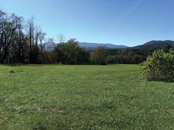 Currently planted as a fescue hayfield, the land borders the Little Tennessee River and could be restored as important early successional habitat. Donated photo
A recent land purchase by Mainspring Conservation Trust could spell a new era for the Bartram Trail in Macon County.
The nonprofit purchased two tracts totaling 71 acres — sandwiched between the Needmore Game Lands and the Nantahala National Forest, and running along the Little Tennessee River — in July, with hopes of eventually conveying the property to the N.C. Wildlife Resources Commission.
“The area has been a focus of the organization since its inception, so really we’ve been looking at the area for over 20 years,” said Jordan Smith, land conservation manager for Mainspring.
Together, the tracts cost $760,000, with a large portion of that funded through a donation from Fred and Alice Stanback. A grant from The Conservation Trust for North Carolina helped with transaction costs and other expenses.
The Little Tennessee River Valley is a biologically rich area, with the river itself classified as a State Significant Aquatic Habitat and home to many rare species, including four mussel and two fish species. The newly conserved land contains three-quarters of a mile of river frontage, as well as rare montane alluvial forest and floodplain pool habitats. Previously used to grow hay, it provides vital early successional habitat for declining bird species such as yellow-breasted chats, field sparrows and indigo buntings.
However, the property has another important attribute as well — it adjoins the spot where the Bartram Trail exits the Nantahala National Forest to begin about 10 miles of road walking before entering the forest once more.
Related Items

The art of the tale: Pigeon Center storyteller series focuses on conversations

Presentation to focus on conservation strategy

Learn about conservation in WNC

Smokies Life CEO to retire
“Back when we first got hold of that land and scouted out a way to come out to Hickory Knoll Road, I kept thinking, ‘Oh, if only we could have a parking area right over there for the trailhead,’” said Burt Kornegay, longtime member and past president of the Bartram Trail Society. “That’s exactly what’s needed here. And that’s what’s happened, though I haven’t had anything to do with it.”
During the same 20 years that Mainspring has been eyeing the area for conservation, the Bartram Trail Society has been working on trail routes. Previously, the trail exited the Fishhawk Mountains at Buckeye Creek, about 5 miles short of the range’s end near the Hickory Knoll Road site. While Hickory Knoll Road had always been the preferred spot for a trailhead, private holdings bordering the national forest made connection impossible.

The newly conserved land links the Needmore Game Lands, owned by the N.C. Wildlife Resources Commission, and land recently added to the Nantahala National Forest. Donated map
But a more recent pair of land acquisitions enabled the society to build the first addition to the Bartram Trail since the 1990s. The work contract was awarded to Virginia-based High Country Conservation in 2015, and the project is now complete, funded by $75,000 from the Federal Recreational Trails Program and $19,000 from the Bartram Trail Society. The U.S. Forest Service, which now owns the property where the new piece of trail is located, oversaw the work.
While the new trail is now finished, it’s not well used. That’s partly because of limited parking — the piece of land connecting the last part of the trail to the road is quite narrow, with the existing parking area large enough for only one to two cars. Mainspring is in the process of developing plans and a budget for a larger parking area on the newly conserved property, which includes parcels immediately adjacent to and directly across the road from the new trailhead.
“The parking lot will not only provide people a place to park their cars, but it will draw more attention to that part of the trail,” said Smith.
The 114-mile Bartram Trail runs from Pine Mountain, Georgia, north to the summit of Cheoah Bald near Robbinsville, following as closely as possible the route famed botanist William Bartram took on his 18th-century travels through the area. Bartram made his way through the Southeast between 1773 and 1777, writing detailed descriptions of the plants, animals and peoples he encountered, writings that he published in the 1791 book Bartram’s Travels. Bartram and his father John Bartram are credited with identifying more than 200 plants in the previously little-explored region, including the Franklinia alatamaha. They’re said to have saved this flowering tree from extinction with the seeds they collected from it.
However, achieving an exact replica of Bartram’s journey in a 21st-century world is challenging — if not, at times, impossible.
“The biggest problem with the Bartram Trail, the biggest challenge it faces as a trail is getting across the Little Tennessee River Valley, through Franklin to the Nantahalas,” said Kornegay. “That’s the way Bartram went, but the way Bartram went now lies under (U.S.) 441.”
In addition to a U.S. highway along which it’s legally impossible to route a trail, the corridor contains a patchwork of private land that makes an alternate route equally difficult to achieve. That’s why the trail follows about 10 miles of back roads after exiting the forest at Hickory Knoll Road, not leaving the asphalt until coming out through the other side of Franklin.
“Ninety-five percent of it’s private, so there’s really no way that you’re going to get a trail built across all that private property,” Kornegay said. “It’s not going to happen. Not in my lifetime.”

Becky Kornegay, wife of Burt Kornegay, stands at an overlook located along the new stretch of Bartram Trail that the Bartram Trail Society dubbed Kornegay Point. Burt Kornegay photo
However, trail users do have another option. About 2 miles up the road from the Hickory Knoll Road trailhead, there’s a canoe launch that allows the hiking trail to turn into a water trail until a boat takeout in Franklin. The Mainspring purchase creates the opportunity to someday establish a boat launch directly across the road from the trailhead, rather then leaving a gap covering 2 miles of roadway. It’s possible that in the future the land could even host a camping area for Bartram Trail thru-hikers.
Smith said a river access there would be wonderful, though site development other than parking area construction would depend on the wishes of whoever ultimately wound up owning the property. As of now, Mainspring is hoping to sell it to the Wildlife Commission, but it’s unknown whether the agency wants to buy the land or if and when it would have the funds to do so.
In any case, Mainspring plans on owning the land for at least three to five years and doing what it can to restore and improve it in that time period. Smith has his eye on projects to reduce erosion along the streambank and replace the existing fescue fields with a greater diversity of native plants.
“While we have that we’ll continue to manage it and be good stewards of land,” he said.