New Bartram Trail map offers all the details
Hikers and map geeks will revel in poring over a new map of the Bartram Trail being released this week.
The map covers a 75-mile stretch of the Bartram Trail that winds through the Nantahala National Forest of Macon and Swain counties. The map labels campsites and springs for water sources, scenic vistas, prime wildlife viewing areas, picnic areas, canoe access and sundry other points of interest.
“When creating the new map, day hikers, backpackers, exercise runners, nature photographers, wildflower enthusiasts, and area history buffs were all kept in mind,” said Ina Warren, a member of the N.C. Bartram Trail Society.
As a perk, the map has driving directions to many of the trail heads, and phone numbers and locations of forest service ranger stations.
Topo lines are at 50-foot intervals. The map’s scale allows for smaller creeks and finger ridges — ones that usually go unnamed on most maps — to be labeled.
The full-color, two-sided map features heavyweight, glossy paper that will hold up to being hauled in and out of your backpack pocket.
Related Items

Incumbent Parton, newcomer Lawson win Swain County Commission Republican primary

Drought disaster funding available for farmers

Reimagine Bartram’s travels

Drought arrives in the mountains
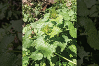
The long-distance trail follows the 1775 route of William Bartram, an early explorer and naturalist, through the region.
Plant collecting in new lands was all the rage during Bartram’s time, often funded by the royal crown back home. Bartram’s journey was popularized at the time in the book Bartram’s Travels. In addition to collecting plant and seed specimens, Bartram described the landscape and the Cherokee Indians with admiration.
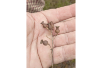
In keeping with Bartram’s spirit, the map features native flora and fauna notes from along the trail.
“We hope this attractive, colorful and informative map will excite folks enough to plan a recreation outing or hike in their national forests and gain many years of enjoyment from the map.”
A grant from the Blue Ridge National Heritage Area laid the ground work for the map project and was matched by substantial contributions from the Highlands Biological Foundation, The Wilderness Society, Nantahala Outdoor Center, private donors and members of the Bartram Trail Society.
The Bartram Trail Society has given out over 1,000 free maps to schools, public and college libraries, summer camps, chambers of commerce, visitor centers, nature centers, museums and other groups.
The map goes on sale this week at local outfitters and forest service ranger stations. It may also be ordered online at ncbartramtrail.org or by mailing a check for $12 (which includes postage) to NC Bartram Trail Society, P. O. Box 968, Highlands, NC 28741. This email address is being protected from spambots. You need JavaScript enabled to view it..