
Outdoors Latest
More ranger-led programs set for 2024
The National Park Service (NPS), in partnership with Catalyst Sports, Knox County,…
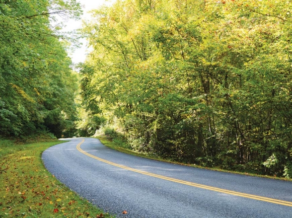 The Blue Ridge Parkway undulates where the Rattlesnake Mountain Tunnel bypass trail emerges. Holly Kays photo
From towering mountains to shimmering seas, North Carolina has a little bit of everything — and for the trail that ties it all together, a major milestone has just been marked.
On Wednesday, Oct. 3, trail volunteers, government officials and natural resources workers from across the state gathered at Oconaluftee Visitor Center in the Great Smoky Mountains National Park near Cherokee to celebrate completion of a 300-mile section of the Mountains-to-Sea Trail, starting at Clingmans Dome and ending at Stone Mountain State Park in Allegheny and Wilkes counties.
“We’re all connected as North Carolinians, and this trail is a symbol of that connection,” said Dwayne Patterson, director of the N.C. Division of State Parks and Recreation, at the Oct. 3 ribbon cutting.
Through Western North Carolina, the MST mostly parallels the Blue Ridge Parkway, the painstakingly built trails making use of the same contours that the Parkway’s builders scouted out years ago. It diverts from the road at times, jutting deep into wilderness areas or national forests and using existing trails where possible, eventually parting from the Parkway permanently at Stone Mountain State Park.
But that first section of the Parkway, beginning just north of Cherokee and continuing on to the intersection with Heintooga Gap Road, near the Plott Balsam overlook, posed a problem. It contains some of the steepest, most rugged land along the Parkway’s 469 miles, including five tunnels. It’s not the easiest place to build a trail.
While the MST route could include some roadwalking in a pinch — about 4 miles of the 300-mile western section is routed along the grass beside the Parkway asphalt — it wouldn’t be safe for hikers to trek through an enclosed tunnel with cars speeding by.


“We had decided there is no way we can build that difficult route from Clingmans Dome in the Great Smoky Mountains National Park. There’s just no way we can do it. Well, 50 years later they did it,” said Doris Hammett, one of the MST’s original advocates, after the ceremony.
Hammett, who lived most of her life in Waynesville but now resides in Asheville, was in the room during a 1977 National Trails Symposium meeting at Lake Junaluska, when then-N.C. Secretary of Natural Resources and Community Development Howard Lee challenged North Carolina to build “a state trail from the mountains to the coast, a trail leading through communities as well as natural areas.”
The challenge ignited the imaginations of those present, including Hammett, who is now 94 years old. They organized into districts, with Hammett part of the furthest-west Balsam Highlands District. She helped scout the route for the future trail, and then helped to build it.
“We would build piece-by-piece, foot-by-foot, starting on the easiest section and just kept working,” she said.
But that section east of Cherokee remained stubbornly impregnable.

The tunnel is one of five that a recently completed section of the Mountains-to-Sea Trail had to bypass. Holly Kays photoThe tunnel is one of five that a recently completed section of the Mountains-to-Sea Trail had to bypass. Holly Kays photo
That is, until certain volunteers with the Carolina Mountain Club took it upon themselves to move the needle.
“My feeling was they weren’t making any headway with the Cherokee,” said Les Love, one of the lead volunteers with CMC. “I said, ‘Well, who’s been over to talk to the Cherokee?”
That question led him to the office of then-Vice Chief Larry Blythe, who also served as the tribe’s forester.
“We talked for almost an hour the first time,” said Love. “All we needed was permission to use the Bureau of Indian Affairs Road, so that gave us a bypass around three tunnels. Once we got that, the work was getting the other two tunnels bypassed.”
BIA Road 407 is a dirt/gravel road that runs from the Big Witch Overlook of the Parkway to Heintooga Road, cutting off just over 3 miles of what would otherwise have been Parkway roadwalking. While the BIA route is still technically a roadwalk, it feels more like a trail.
Around 4 p.m. on a Wednesday, the Parkway was mostly sunny, with cars steadily rushing past at 40, 50, 60 miles an hour. By contrast, the BIA road was shaded and quiet, pockets of water and thickly growing understory covering the ground around it. The road quickly began to climb uphill on its way to the Mile High Campground, the wet forest giving way to drier surroundings, squirrels chattering loudly and cicadas even louder, the greenery wrapping the road showing the first yellow hints of fall.

Government officials, National Park Service leaders, trail volunteers and community members alike cut the ribbon on the newly completed MST section. Holly Kays photo
A 30-minute walk along the road included zero car sightings, though imprints of tire tread in the dust and the occasional discarded Budweiser can or Marlboro carton showed that cars do use the road intermittently, at least.
“It was just a good fit,” said Blythe, who served as vice chief from 2003 to 2015. “Low-impact, no intrusion on individual tribal members’ holdings, and the road was already in existence.”
That fit was formalized in a July 2015 resolution, with Tribal Council voting unanimously to become “an official sponsor of the section of trail within the Mountains-to-Sea Trail project that crosses tribal trust lands.” CMC could then turn its attention to figuring out how to bypass the remaining two tunnels.
It wasn’t easy. Building the roughly 0.6 miles of trail needed to skirt Rattlesnake and Sherrill Cove tunnels required an army of CMC volunteers bearing hand tools, along with an N.C. State Parks crew that used a machine to rough in the route initially. The trail work wrapped up at the end of July, and the trails were blazed in the months following.
The result is a set of freshly minted trails that not only make the MST safer to navigate but allow hikers to spend even more time immersed in the hardwood forests of WNC rather than slapping asphalt and battling with the whizz of cars in their quest for solitude.
Hiking the Rattlesnake Mountain bypass, for instance, Parkway traffic is still audible off in the distance, but chirping birds, scampering chipmunks and determinedly drilling woodpeckers create the most noticeable layer of sound.
At first, coming from the Cherokee direction, the trail veers off like it’s trying to take you back where you came from, but then it rights itself and circles back uphill, marching through a steep climb to the crest of the hill, snippets of winding road visible through the spaces between trees. Despite the elevation, the place attracts moisture-loving trees like tulip-poplar and hemlock — young hemlock trees still struggle along, the ghosts of the older generation sticking up naked from the drainage, victims of the hemlock wooly adelgid — as well as red maple, striped maple, oak and sourwood.
It’s been a long road, with Love estimating that the effort to close the 8 miles from the Parkway’s southern terminus to Heintooga Road took nearly 10 years total. It’s an effort he carried on for so long not only out of love for the trail but out of a desire to carry on the legacy of dedicated volunteers like Allen DeHart, who passed away in 2016.
With only 680 miles of the 1,175-mile route completed, there’s still plenty of work left for MST lovers to tackle. But if the progress made since Lee first posed his wild idea to a group of hikers in 1977 is any indication, there’s hope that it will one day come to fruition.
“One of the great quotes from back in 1977 to me is the governor’s quote, and he said, ‘I’ll support the trail, but I’m not going to put any money into it,’” said Brian Strong, chief of planning and natural resources for the N.C. Division of Parks and Recreation. “And hasn’t that been the story of the trail for so long? The trail has survived basically on the support of individuals, and so many of those individuals.”
Volunteers are needed to help maintain and expand the MST — especially people living west of Asheville. Most of the Carolina Mountain Club’s membership is in the Asheville area, meaning that a lot of driving is involved when it comes to maintaining the MST’s route in Jackson, Swain and Haywood counties. Volunteers who live closer to the far western trails are wanted.
Find out how to help at www.mountainstoseatrail.org/get-involved or join CMC at www.carolinamountainclub.org.