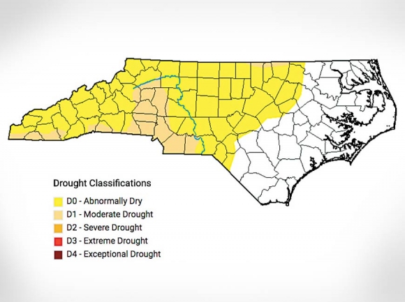
Severe drought has disappeared from the new map, with the number of counties in moderate drought down to 17. An additional 50 counties are listed as abnormally dry. Counties in moderate drought include Cherokee, Clay and Macon, with the remainder of the western and central counties categorized as abnormally dry.
While it was published Oct. 31, the map is based on data gathered through 8 a.m. Oct. 29, meaning that it does not include the effects of heavy rains the region saw Oct. 29 to Oct. 31.
When severe drought conditions were first announced Oct. 3, it marked the first time since April 25, 2017, that severe drought had occurred in North Carolina.
Despite the improving conditions, the N.C. Forest Service is urging North Carolinians to remain vigilant in reducing wildfire risk. While recent rains have brought relief, a spate of warm, dry days with winds could quickly dry forest fuels once more.
Always build campfires in existing rings when possible and clear a safe area around them of at least 15 feet. Never leave campfires unattended, and ensure they are completely out before walking away. Check the weather and local regulations before burning yard debris, and be careful when removing ashes or coals from stoves and fireplaces.